


Wrecks and Underwater Archaeology
1) In Safari, open the Safari menu and select Preferences.
2) Then, click the Advanced tab in the Preferences window.
3) Then, at the bottom of the window, check the Show Develop menu in menu bar checkbox.
4) Finally, open the Develop menu in the menu bar and select Enable WebGL.
Have fun!
1) Use a browser such as Google Chrome or Mozilla Firefox,
or
2) Install IEWebGL, a 3rd party WebGL renderer for Internet Explore.
Have fun!


Application Overview
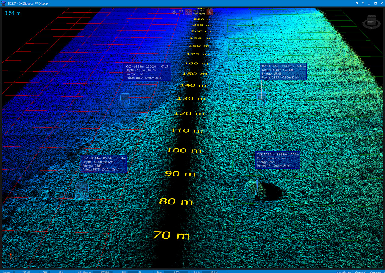
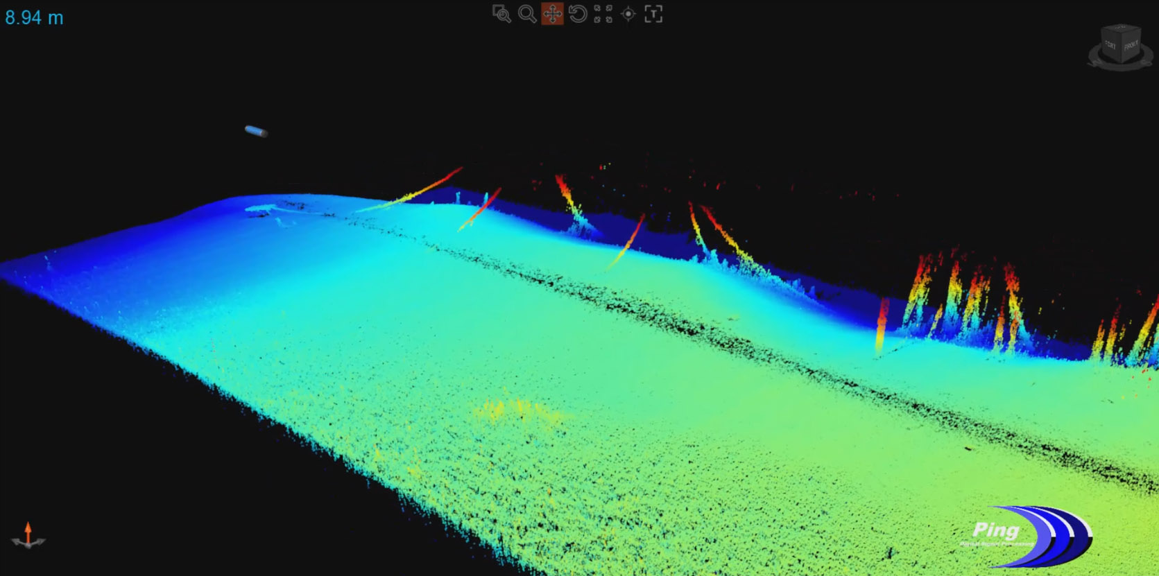
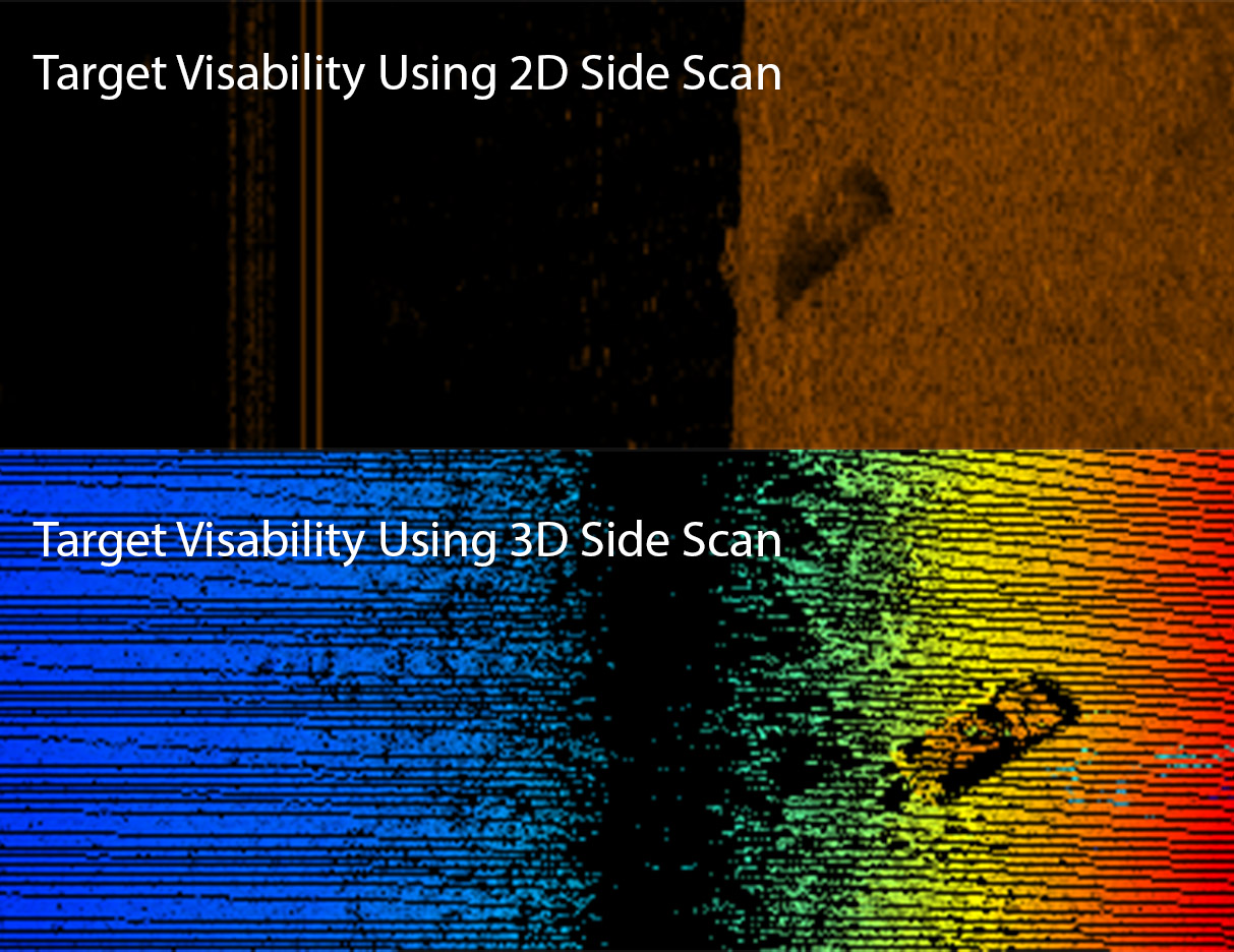
A 3D side scan image is generated ping by ping just as images are generated for 2D side scan, however backscatter is also tracked in elevation angle with multiple concurrent arrival angles being tracked simultaneously and independently. The 3D side scan image is called a point cloud and is geometrically correct version of a standard 2D side scan image.
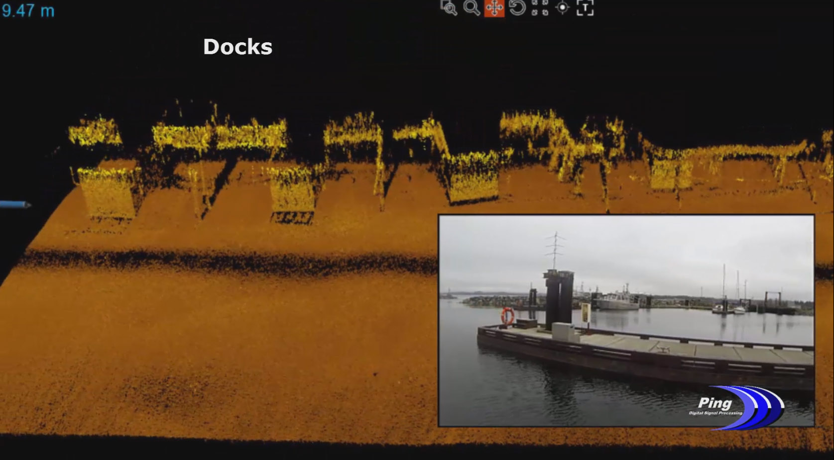
Structures such as shipwrecks, bridge abutments, dam faces, and other underwater objects can be imaged using both standard side scan and 3D side scan output from the 3DSS sonar. The 3D side scan point cloud image can be rotated and manipulated to provide 3D views of object geometry in side scan imaging detail. This allows for assessment of every feature as a orientable, geometrically correct surface in the 3DSS Display software. This provides powerful insights into the condition or stability of a wreck or structure and enables enhanced awareness and decision making for crews.
For more information on the HMCS Mackenzie and other artificial reefs in British Columbia, visit the Artificial Reef Society of BC.
J.E. Boyden
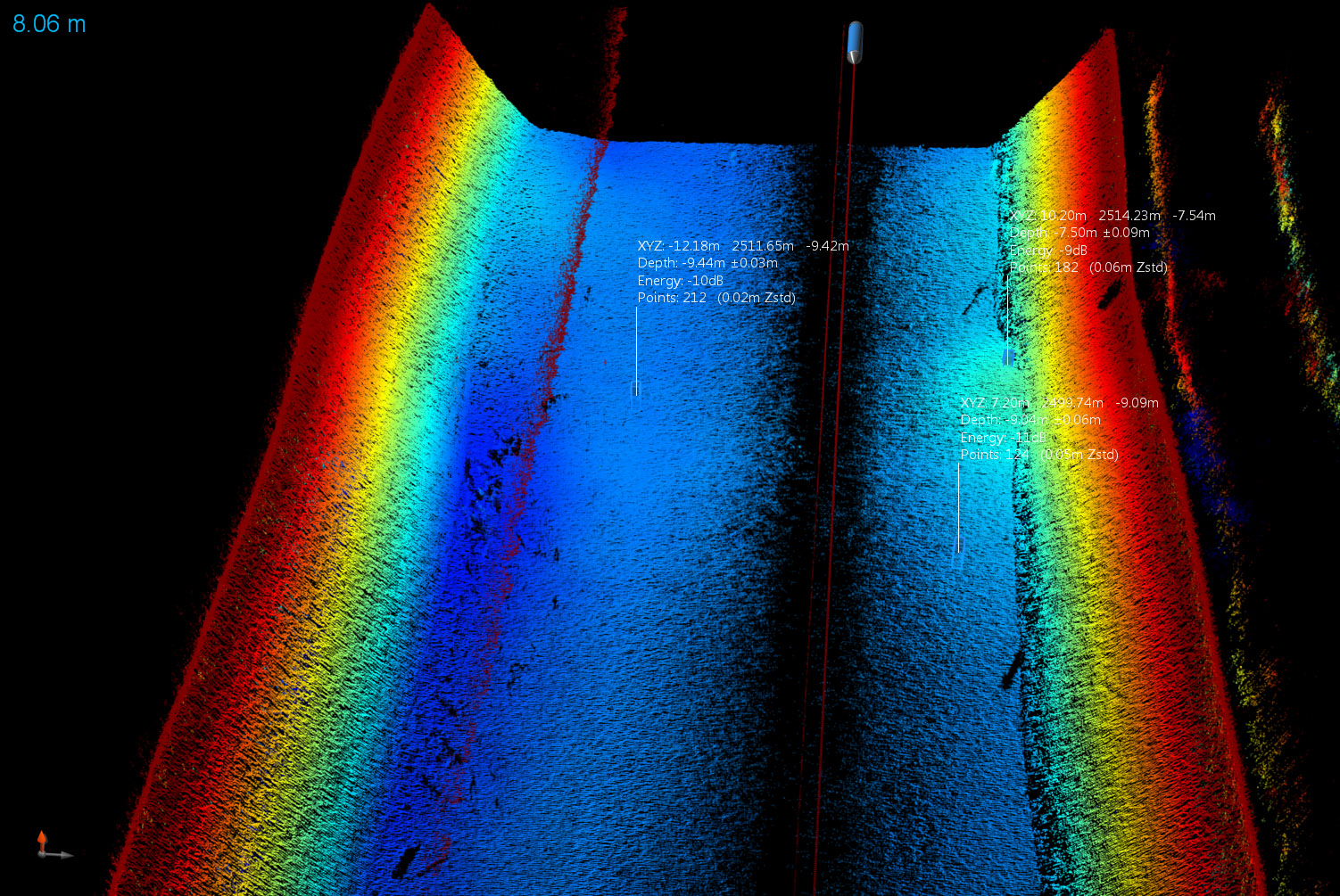
The wreck of the J.E. Boyden lays at the bottom of Lake Union, WA. Once a common sight along the shores of Puget Sound and Vancouver Island, the 85’ J.E. Boyden served as a cargo hauler and tug vessel for almost half a century during the final days of the tallship bulk carriers. Scuttled in 1935 in 40’ of water, the J.E. Boyden is still well preserved and its integrity and orientation have been documented using 3D Sidescan Sonar technology from Ping DSP Inc. Displayed in both backscatter intensity and depth colorization, the J.E. Boyden is displayed geometrically correct.

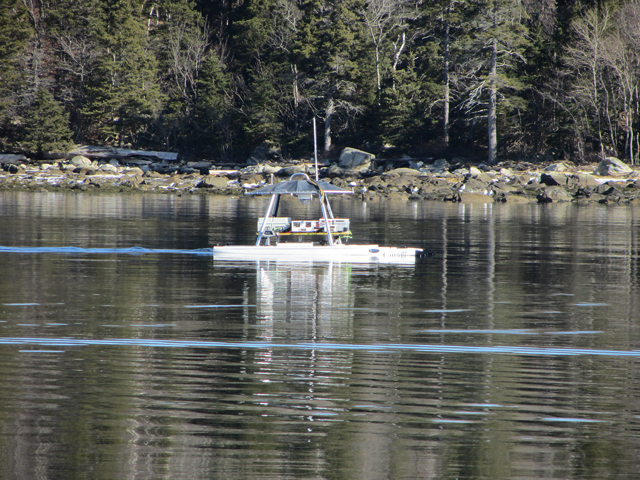
Our Own Backyard
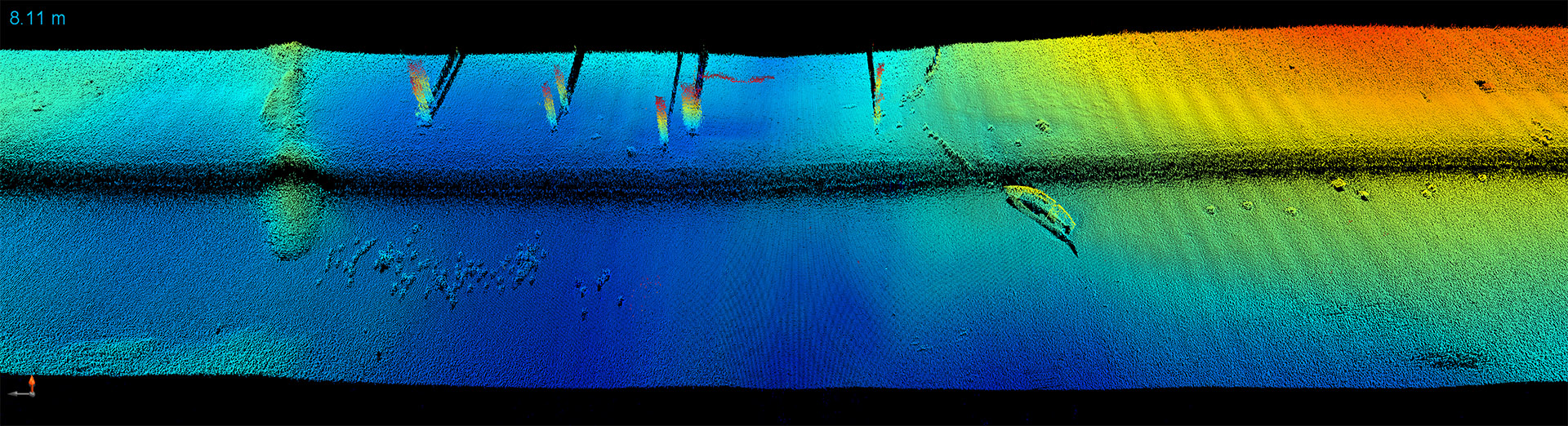
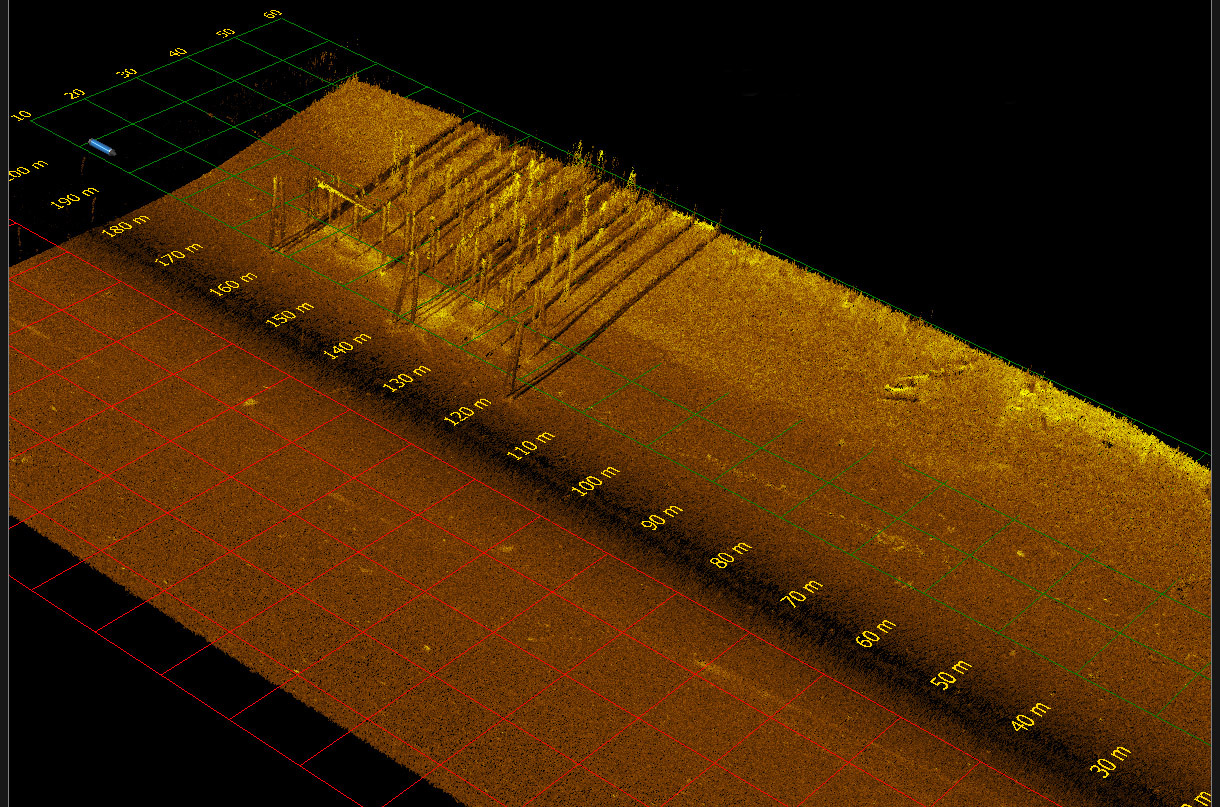
Just off the end of the pier outside our office at Deep Cove Marina in North Saanich, Vancouver Island, there is a wreck of an old rail barge that sank in the 1950s. Known only to local divers and historians, the barge was on its way into the harbor when it struck a reef and sank approximately 100 feet from the dock. Now, with 3D Sidescan Sonar technology from Ping DSP Inc, a complete view of the wreck site is available. A 3D image of the barge wreck was created in real-time with a single pass. The data is shown in Ping DSP’s software and has not been cleaned or altered from the real-time view. Of particular interest are the vertical timbers remaining from the barge structure and clearly evident in the 3D image.